
Discover the Possibilities with 3D Laser Scanning
Our Services

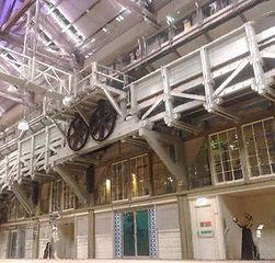
Architecture - Building Scanning & Documentation
In the time it takes to walk through a project site a 3D model of your building inside and out can be captured. The completed scans from the 3D laser scanning process can be provided as a “pointlcloud”, 3D polygon model or as orthographic 2D plans, elevations & sections that can easily be viewed, modified and added to within widely used CAD programs such as Revit, AutoCAD, MicroStation, ArchiCAD and SketchUp.


Planning - Urban 3D Mapping
3D laser mapping can capture the 3D geometry of an urban environment within minutes and in great detail, allowing for the data to be used with most CAD software or available online for collaboration within a project group.


Project Tender - Quantify Existing Site Construction
3D laser scanning can capture the exact overall geometry of your building, enabling the calculation of existing materials and surface areas which can be documented ready for contractors to be engaged. An example would be quantifying and documenting the Aluminium Composite Panels (ACP) panels that require replacement.


Modelling - 3D Asset Creation
Detailed 3D mesh modelling is possible, derived from the 3D laser scanning pointcloud.


Heritage - Preservation Documentation
There is no better way to capture all relevant details of a heritage listed building than with 3D laser scanning. Whether it is to assist with documentation necessary for a heritage report, to document a building for current maintenance or future preservation work or to assist the design and planning process for alterations and additions, 3D modelling for the project will assist with the end result.

Aerial Photography - Architectural Visualisation & View Photography
Combining over 10 years of high quality architectural visualisation & photography of existing site views with the use of the latest in available aerial photography technology. We provide everything required to market and approve your project. We can help identify visualisation opportunities from the project site, provide an initial proposal of the overall visualisation language and proposed image set.


We Integrate With Your Way of Working & Workflow
Ready to work with your Team - The completed scans from the 3D laser scanning process can be provided as “pointlcloud” or as a 3D polygon model that can easily be viewed, modified and added to within widely used programs such as Revit, AutoCAD, MicroStation, ArchiCAD, SketchUp & 3D Studio Max.
Share & Communicate Effectively - Access your project when needed online and remotely. Allow multiple members of your team to also access and collaborate remotely with the 3D models provided via your average laptop or phone for maximum flexibility.